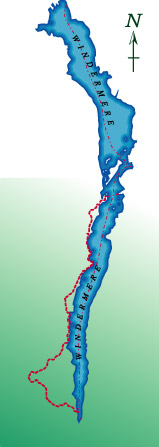
Ferry House to Lakeside
Distance Distance 7.5 miles Time 4 – 5 hours
This is perhaps the quietest part of the walk and includes two delightful lakeshore sections. However the footpath is so close to the waters edge that in periods of wet weather, some places are prone to severe flooding. There is about a mile of walking along a relatively quiet road and a couple of short sections on the busier Lakeside to Hawkshead road, where care is needed.
Ferry House stands on a narrow peninsular and was once the home to the Centre for Ecology and Hydrology laboratories. In the summer long queues of traffic build up awaiting the ferry back to Windermere. From the ferry, follow the road south along the lake shore until the second path on the right, signposted to Beatrix Potter’s house, Hill Top. This permissive path follows the road and mid way up the steep climb to Far Sawrey crosses to the other side. The path rejoins the road just by the junction to Cunsey. Take the left turn and after about twenty yards, left again and down the hill. Follow this road through woodlands for a third of a mile and look out for the footpath sign on the left.
The path now follows the lakeshore through pleasant meadows, crossing Cunsey Beck on the way. After prolonged rain, the beck will burst it banks making wet feet an inevitability. The path rounds Rawlinson Nab and continues south before joining the road after a quarter of a mile. Turn left along the road which at first closely follows to the lake before climbing steeply up towards Graythwaite Hall.
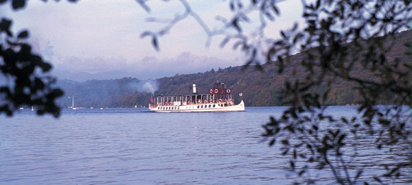
The ‘Tern’ heads towards Lakeside
At the top of the hill a sign marks a footpath on the left that descends through woodland again to the lakeshore. This path can be very wet and muddy at the best of times and is also prone to flooding.
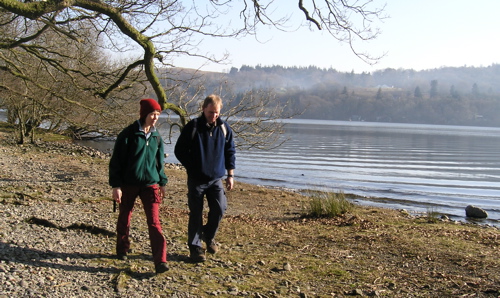
Walkers on the lakeshore near Rawlinson Nab
This section of path is just over a mile but with it’s twists and turns seems longer. Watch out for the sharp left turn immediately after a lakeside cottage, Alders and Birches crowd the lakeshore framing different views of the lake at every turn. In Great Oaks Wood, the path takes a sharp right turn and winds it’s way back to the road. Follow the road south to where it emerges near the YMCA Lakeside centre.
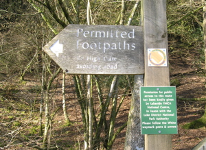
The Sign to High Dam
Traffic can be busy here but after a hundred yards or so a permissive path on the right hand side leads up the fellside and away from the road again. A hundred yards or so up the path there is a gate with a ‘Permitted Path’ sign pointing left. Ignore this and go through the gate and cotinue up to Stott Park Heights revealing a surprising viewpoint as you come out of the trees. Navigation from here to High Dam needs care. The top is a flat grassy area. Take the path at the northern end that descends to the west. This curves around to the south before crossing a beck at some rather dodgy stepping stones. Climb the path that rises gently opposite. A kissing gate gives access to the delightfully situated High Dam.
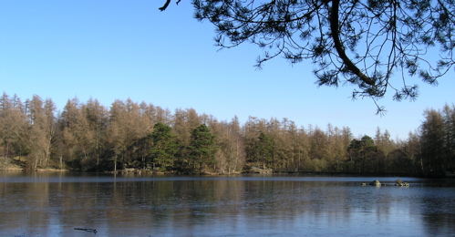
High Dam under a clear winter sky
This is not a natural tarn and has been dammed to supply water to the Bobbin Mill at Low Stott Park. If you made an early start, turn right and take in the circuit of the tarn first. It’s also an excellent place to stop for lunch. If time is pressing turn left and follow the path past the dam and down through woodland. Where the main path curves away to the left, take the steeper fork to the right. Just before the gate at the foot of the woods, look out for a path on the right that crosses the beck. Cross a field and descend to Finsthwaite village.
At the road turn right and twenty yards on, take the lane on the left. At the church, follow the path that goes straight ahead across a couple of fields and into Great Knott Wood before rejoining the main road. Turn right and after a quarter of a mile, by the Lakeside Hotel, turn left to the Steamer Pier.