Lakeside to Bowness Bay
Distance 14.5 miles Time 6 – 8 hours
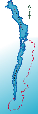
This is the longest section of the route at 14 and a half miles. If this is too long for a day’s walk, there is a seasonal passenger ferry that operates between Lakeside and Fell Foot park on the opposite side of the lake. This will save about 3 miles walking. Should you need to resort to public transport, there are several points where the route can be left and a descent made to the A592 where there is an occasional bus service. Access to the lakeshore is limited to one point near the Beech Hill Hotel and this tends to get crowded, so our route eschews the shore altogether and concentrates on the tops, affording some fine views along the way.
Leave Lakeside steamer pier and turn left along the road. This is not the best road to walk along but a permitted path on the right avoids the traffic for most of the way to Newby Bridge. Cross the railway and river bridges and turn left along the main road. Just before the roundabout a minor road, signposted Canny Hill, leads off to the right. Follow this road for half a mile and take the path on the left through the caravan park. Just past the visitors car park, drop off the road and through an old stone stile, hidden behind bushes. Cross a field and recross the busy A590 and then the field opposite.
This very flat area at the foot of the lake was once part of the lake bed and the lake originally flowed out to the sea from roughly this point down towards Cartmel. The current river Leven being more recent when the water broke through to force a new route, probably at the end of one of the ice ages. The path skirts around to the right of Chapel House, before joining the minor road. Cross the road and climb diagonally across the field to a stile leading into Chapel House Plantation.
The path here is indistinct at first but soon joins a wider track. Follow this left, till it in turn joins a wide, forestry track. The original footpath, which is marked with yellow arrows, runs parallel to this track but the track is the easier option. This track climbs steadily northeast before widening out at a junction, with the main path turning sharp right. Ignore the turn and carry straight on. The track deteriorates very quickly and after a hundred yards, splits into two. Take the left hand fork. This path can be very wet and boggy in damp conditions and has a tendency to be overgrown but after half a mile the surface improves and almost immediately a crossroads is reached. Turn left and follow this better track to a gate at the forest edge.
Turn left along the minor road and left again at the T junction ahead. A couple of hundred yards brings you out of the forest again and the path to Gummers How is on the right. Follow this path to the summit. Gummers How is the southern equivalent of Loughrigg giving extensive views along the lower half of Windermere. From the summit, descend Northeasterly towards a small reservoir in the woods. The path through these woods is not marked on current OS maps but a stile leads into the woods and a sign from the owners welcomes walkers. Follow the path down to the reservoir. Do not walk along the dam wall, instead drop below it, turn left at the junction and climb up past the farther end on a reasonable track. This ends abruptly and there is little evidence of a path on the ground at this point, but a clear ride winds through the trees, marked reassuringly by occasional guide posts.
Climb the slope, keeping clear of the trees until a good track is rejoined. Follow this little used path for half a mile through the forest till it joins another path heading north. Turn left along this path which crosses a very boggy area, before climbing a brow then descending into Blake Holme Plantation. At the foot of the descent, just before the path crosses Burrow Beck, turn right and climb gently again in a northerly direction. This is a delightful stretch of woodland and usually one of the quieter sections of the route. Leave the woods via a stile and follow the path downhill. After the second gate, there is a path junction, in the middle of the field.
The route goes straight on but first, a short detour to the summit of Moor Howe is recommended. Take the path that goes left and go through the small gate in the wall. Turn right and climb to the top of the fell. This is another fine viewpoint and usually less crowded than the previous top at Gummers How. Retrace your steps to the previous path junction and continue towards Moor Howe Farm.
The path detours around the farm. After the last farm building, follow the track around to the left to join the road.
Note: There is currently a problem with access around Low Moor How. Details are in the sidebar and on the Blog Page
This leads down to the junction at the top of Birks Road. Cross the junction and follow the road signposted to Bowness. A quarter of a mile on, take a turning into a gated road on the right. This in turn becomes a bridleway which climbs over the fell with views down into the Winster Valley. There are several turnings but stay on the main path until you reach a gate above High House Farm. Take the bridleway that goes slightly left and follow this till, with a final sharp kink to the right, the path meets the A5074 Bowness – Lyth Valley road.
Cross over to the track opposite and fifty yards along look out for a stile in the wall on the left. This path, which is not much in evident on the ground, goes to the left of a small hill before descending towards a cottage. Join the track that leads through a the cottages to come out on Lindeth Lane. Turn left and follow to a crossroads with the B5284. Cross over and after a couple of hundred yards take the first footpath on the left. This track leads to Brantfell farm.
Look out for the line of cairns behind the farm and follow these to the top for a final summit on Brantfell. Brantfell again gives extensive views of Belle Isle and both ways along the lake. Descend again along the line of cairns and keeping to the left, cross the stile at the bottom. Cross this field to another viewpoint at Post Knott. The path goes right to a gate. Go through this gate, turn left and follow the path as it descends round to the right. The view of the north basin on Windermere is framed by the mature trees growing alongside the path and is one of the finest on the whole walk. A kissing gate on the left leads down through a field and out to the top of Brantfell Road. Descend this road, cross Kendal Road at the bottom and turn left opposite the Church to return to the starting point at the steamer pier in Bowness.