Ambleside to Ferry House
Distance 13.25 miles Time 5 – 7 hours
Ambleside is a great base for a walking holiday. Surrounded by the hills and magnificent scenery, there are a great many Ambleside walks to choose from and the Windermere Way route starts by climbing on of the best, Loughrigg Fell, giving great views of Ambleside and Windermere on the way.
Start at the southern end of Ambleside by Waterhead pier, but if your’e staying in Ambleside itself, it’s perhaps easier to head directly to the Rothay Bridge.
From the pier at Waterhead, turn north and walk along the short promenade. Continue along Rothay Road passing the old Roman Fort at Galava on the left. Turn left at the rugby club and as the road curves to the right, cross the river Rothay via the footbridge. Turn left and follow this road alongside the River Brathay for 600 yards as far as the next junction at Clappersgate. Cross over here and take the signed footpath opposite the turning to Hawkshead. This climbs steeply up Loughrigg Fell eventually coming out near Lily Tarn. This is an excellent viewpoint for both Ambleside and the northern half of Windermere. The steep climb over such a short distance leaves you looking right out over the village.
It is particularly effective when walking the other way as the view is only exposed at the last minute. There are so many paths on Loughrigg that if the bracken grew any taller it would rival some of the best mazes in the country. When the mist is down there is no contest. Assuming that you can see where you’re going, follow the broadest path and keep climbing in a North-westerly direction for a mile and a quarter until you reach the top.
he views from here extend all around, enhanced by the fact that Loughrigg stands alone and is surrounded by different lakes. Windermere is left a good way behind, to the north is Grasmere and just out of sight, Rydal Water. If you look further north, Thirlmere can be glimpsed through the pass of Dunmail Raise. To the south, Loughrigg Tarn is immediately below, Elterwater, a little further off and Esthwaite Water more to the south.
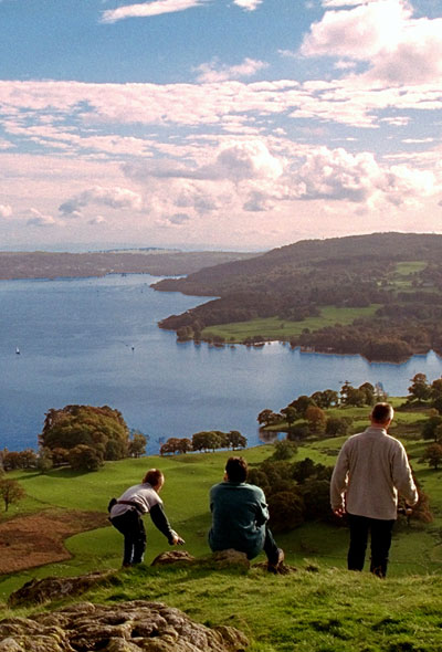
The view south from Loughrigg
Leave the summit by the path that heads Southwest, towards Loughrigg Tarn. This descent is fairly steep and care is needed in places. At the foot of this path, turn left and shortly after, go through a gate on the right, to join the track around Loughrigg Tarn. Turn left onto this track which contours around the Tarn and rejoins the road at the far end. ( A less steep alternative is to retrace your steps across the top of Loughrigg until the bridleway is reached and descend this to regain the route where it leaves Loughrigg Tarn).
If you are planning on staying in hostels this is a good jumping off point for Elterwater Hostel.
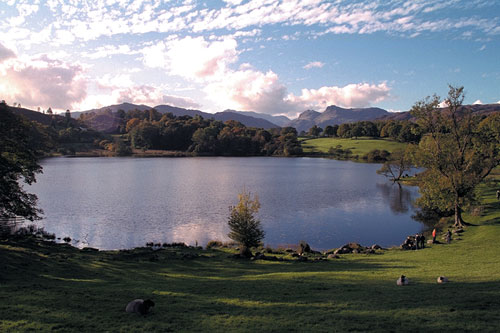
Loughrigg Tarn
Go through the gate, keeping right. Turn right at the road and then shortly left at the first junction and descent to Skelwith Bridge.
Skelwith Force is only a couple of hundred metres up river and recently a dramatic new footbridge has been constructed just above the falls. It’s well worth the diversion to have a look.
The route crosses the road bridge and takes the minor road that goes straight on. Walk up this road then take the first left signposted Skelwith Fold and then the next right, signposted Hawkshead. A hundred yards up this road a footpath leaves on the left, signposted Pull Wyke. At the entrance to the caravan park, keep to the right and follow this path for half a mile till it joins the B5286 Hawkshead road. There is a permissive path on the far side of this road but it only lasts a short distance.
Follow the road southeast for 600 yards then take the minor road on the left. Half a mile down this road you come to the entrance to Low Wray campsite and after a further 300 yards the imposing gateway to Wray Castle. (A new permissive footpath can be used to avoid some of the road here and I’ll update the site once I’ve checked it. That’s the end of the road walking for now and a path on the left just after Wray Castle gatehouse, descends to the lake at High Wray Bay. A good track now follows the lake shore all the way to the Ferry and if lakeside walking is your preference continue on this path.
If you want to regain the heights, however, look out for the bridleway, immediately past Belle Grange. This is the route of the road to Hawkshead from the old ferry opposite at Millerground and although some parts of it have been repaired there is still section of the original paved road which is a joy to walk along. Follow this path as it climbs fairly steeply through the woods. At the next left turn, ford the beck and follow the sign to Far Sawrey via Low Blind How. The path climbs steadily, winding its way through the woods and giving occasional glimpses of the lake before the view final opens up opposite Bowness Bay our original starting point.
Ignore the various paths that leading off to either side and continue south till you exit the wood along a narrow walled lane. After half a mile, this comes to a junction. Turn left and about 200 yards later go through the kissing gate on the right. The path once again follows the crest before plunging steeply through the woods. Just before reaching the road, the path passes through a ruined tower. This is another of West’s Stations. A plaque on the wall describes the way the building looked in it’s heyday. Descend to the road, turn left and follow it to the ferry. You can either get the car ferry directly across to Ferry Nab or join one of the cruise launches that will take you back to Bowness.